15 Nov 2025
National Parks of Salt Spring Island: A Guide to the Island’s Protected Natural Areas
Salt Spring Island is famous for its artists, markets, and waterfront cafés, but its wild landscapes are what truly set it apart. While the island doesn’t have a single standalone national park, it does include parts of the Gulf Islands National Park Reserve and is home to several large provincial parks that many visitors mistake for national parks because of their scale and scenery.
Here’s a look at the national-park–style landscapes that define Salt Spring Island.
Gulf Islands National Park Reserve
Salt Spring’s official link to the national park system is through the Gulf Islands National Park Reserve (GINPR), a collection of islands, islets, and protected marine areas throughout the Salish Sea. Although Salt Spring does not host a major land section of the reserve, several marine zones and offshore islets around the island fall under GINPR protection.
These areas are especially appreciated by kayakers, wildlife lovers, and anyone seeking quiet natural spaces.
Highlights of GINPR near Salt Spring:
- • Rocky coastline and kelp forests
- • Garry oak meadows, one of Canada’s rarest ecosystems
- • Habitat for seals, otters, seabirds, and migratory species
- • Calm waters ideal for kayaking and paddleboarding
Quick facts:
- • Park type: National Park Reserve
- • Ecosystems: Coastal Douglas-fir, Garry oak, intertidal zones
- • Activities: Kayaking, shoreline exploration, wildlife viewing
To get a sense of what GINPR feels like, here’s a short Parks Canada video:
Ruckle Provincial Park
Ruckle Provincial Park is the largest and most famous protected area on Salt Spring Island. With more than 1,300 acres of forest, farmland, and dramatic shoreline, it feels every bit as grand as a national park.
Why Ruckle is so loved:
- • Over 7 km of wild coastline
- • Tide pools and rocky headlands
- • Sweeping ocean views
- • Peaceful coves perfect for picnics
- • A working heritage farm dating back to the late 1800s
- • Oceanfront camping just meters from the waves
Ruckle’s quiet forests, rocky shelves, and exposed viewpoints make it ideal for photography, coastal hiking, and wildlife spotting. Visitors often see seals, otters, bald eagles, and marine birds.
Dogs are welcome on most trails (leashed) but are not permitted in active farm areas.
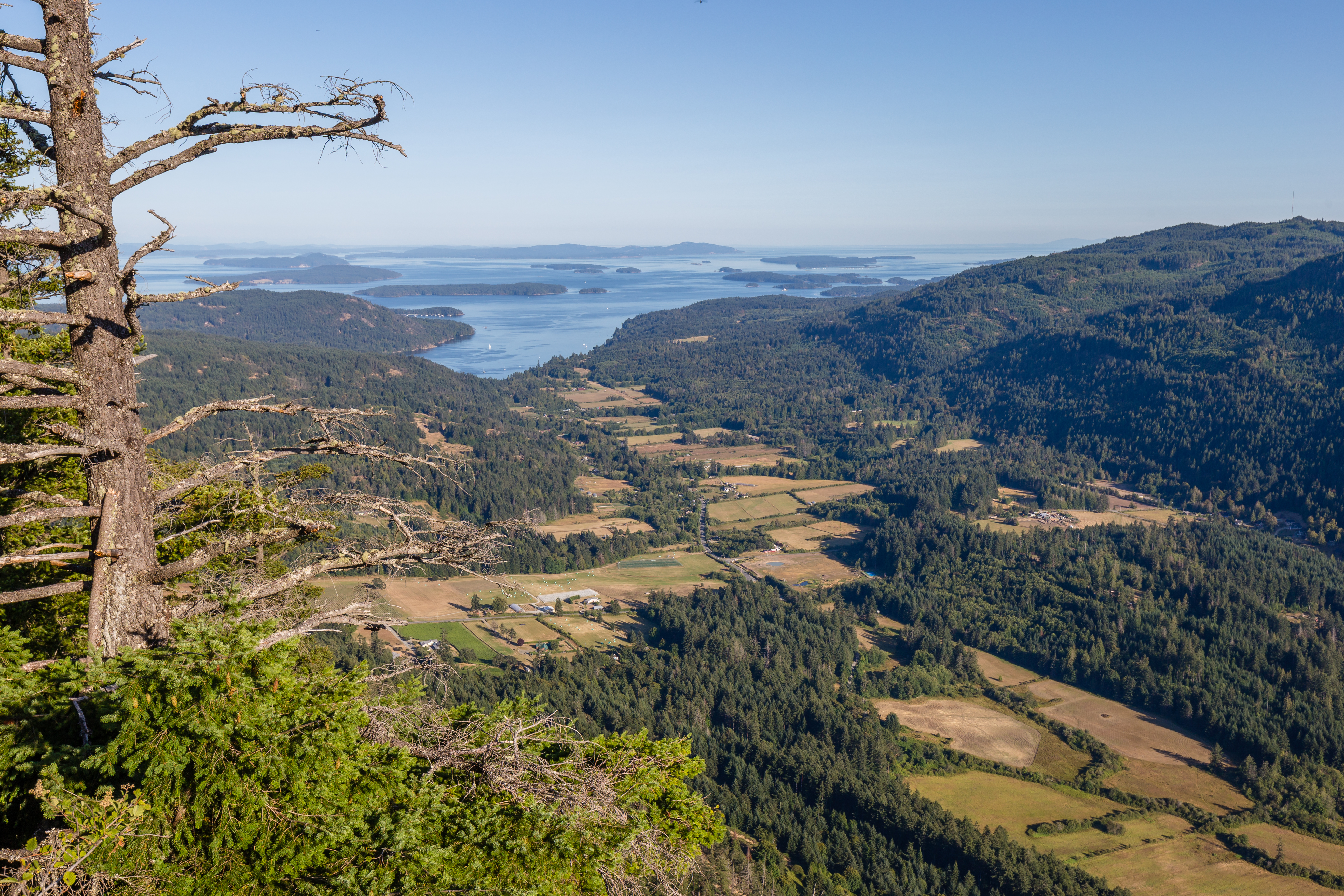
Mount Maxwell Provincial Park
Mount Maxwell, home to Baynes Peak, offers one of the most dramatic viewpoints in the entire Gulf Islands. The summit rises above Fulford Valley and provides sweeping views of Vancouver Island, Burgoyne Bay, and the surrounding islands.
What to expect at Mount Maxwell:
- • Cliff-edge viewpoints ideal for panoramic photos
- • A mix of forested and rocky trails
- • A rugged road for those driving to the top
- • Protected habitats for rare plants and wildlife
The terrain is a classic example of the coastal Douglas-fir zone: stunted trees, moss-covered rock, and windswept bluffs. Whether you drive or hike, the lookout at the summit is unforgettable.
Mount Erskine Provincial Park
Mount Erskine offers a more intimate, mossy, forested experience. Its trails weave through old coastal forest and lead to granite bluffs with exceptional views of the Salish Sea.
Why people love Mount Erskine:
- • Beautiful forest paths
- • Multiple lookout points
- • Small handcrafted “fairy doors” hidden along certain trails
- • Quiet viewpoints perfect for sunsets
It’s a moderate, rewarding hike with a magical atmosphere that feels different from the rugged cliffs of Maxwell or the coastline of Ruckle.
Why Visitors Think These Are National Parks
Although only parts of GINPR are officially national park land, many visitors casually refer to Salt Spring’s protected areas as “national parks.” This happens because:
- • Ruckle and Maxwell are large, dramatic landscapes
- • The scenery feels like something out of a national park
- • Visitors often search “Salt Spring Island national park” when looking for the island’s best nature spots
Together, these parks create a national-park-level experience even without the designation.
Best Things to Do in Salt Spring’s Protected Areas
Hiking
Salt Spring’s parks offer trails for beginners and experienced hikers alike, from shoreline paths at Ruckle to ridge-top climbs at Maxwell and Erskine.
Kayaking
Calm channels and sheltered coves around Salt Spring fall within GINPR marine zones, making it a top paddling destination.
Wildlife Viewing
Expect seals, otters, eagles, cormorants, herons, and, on lucky days, whales offshore.
Picnics
Coastal meadows at Ruckle and cliffside viewpoints on Maxwell make for unforgettable picnic spots.
Photography
From mossy forests to sweeping summits, Salt Spring offers some of the most photogenic landscapes in the Gulf Islands.
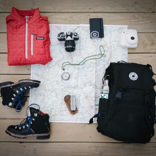
Visitor Tips
- • Wear sturdy footwear, especially after rain
- • Bring plenty of water; parks do not offer potable water
- • Follow Leave No Trace principles
- • Check dog restrictions at Ruckle and GINPR sites
- • Arrive early during summer to avoid parking issues
Conclusion
Salt Spring Island may not have a single national park with its own name, but its mix of Gulf Islands National Park Reserve shoreline, Ruckle’s expansive coast, Maxwell’s dramatic mountain views, and Erskine’s mossy magic creates a nature experience as rich as any official national park.
Whether you’re hiking, kayaking, camping, or simply sitting at a viewpoint watching the light shift over the sea, these protected landscapes capture the spirit of Salt Spring Island. They’re wild, beautiful, and unforgettable — and they’re waiting to be explored.