11 Apr 2025
Looking for peaceful and uncrowded hiking spots? Salt Spring Island, near Ganges Harbour, offers a variety of trails for all skill levels – from easy coastal walks to challenging mountain climbs. Here’s a quick overview of the trails:
- Mount Erskine Trail: Moderate to steep, with stunning sunset views.
- Chris Hatfield Trail: Short but steep, perfect for a workout.
- Reginald Hill Path: Scenic 0.62-mile trail through rare ecosystems.
- Duck Creek Park Trails: A short, lush loop with tidal considerations.
- Mount Maxwell Trail to Baynes Peak: Moderate hike with panoramic views.
- Channel Ridge South Loop: Easy loop with optional challenging sections.
- Ruckle Park Shore Trail: Coastal path with ocean views and wildlife.
- Burgoyne Bay Rock Trail: Rugged terrain with boulder fields.
- Peter Arnell Park Loop: Sweeping vistas and trail connections.
- Hope Hill View Trail: 1.4-mile loop with forest paths and stream crossings.
Quick Comparison
| Trail Name | Difficulty | Length | Key Features | Best For |
|---|---|---|---|---|
| Mount Erskine Trail | Moderate | Varies | Sunset views, Salish Sea vistas | Scenic hikes |
| Chris Hatfield Trail | Challenging | Short | Steep terrain | Fitness enthusiasts |
| Reginald Hill Path | Easy | 0.62 miles | Rare ecosystems, conservation area | Nature lovers |
| Duck Creek Park Trails | Moderate | 0.28 miles | Mossy paths, tidal areas | Short nature walks |
| Mount Maxwell Trail | Moderate | 0.22 miles | Panoramic views, Baynes Peak | Photographers |
| Channel Ridge South Loop | Easy | Loop | Scenic views, gentle paths | Casual walkers |
| Ruckle Park Shore Trail | Moderate | Coastal path | Ocean views, wildlife spotting | Coastal explorers |
| Burgoyne Bay Rock Trail | Moderate | Rugged terrain | Boulder fields, shaded spots | Adventurous hikers |
| Peter Arnell Park Loop | Moderate | Loop | Vistas, trail connections | View seekers |
| Hope Hill View Trail | Challenging | 1.4 miles | Forest paths, stream crossings | Experienced hikers |
Plan your next adventure and enjoy the natural beauty of Salt Spring Island. Remember to follow trail rules, stay safe, and leave no trace!
Mt Erskine Salt Spring Island hike on a Sunday afternoon
1. Mount Erskine Trail
Mount Erskine Trail, located near Ganges Harbour, provides options for hikers of different skill levels. You can take the moderate Trustees Trail starting at Juniper Place or tackle the steeper route from Collins Road if you’re up for a challenge.
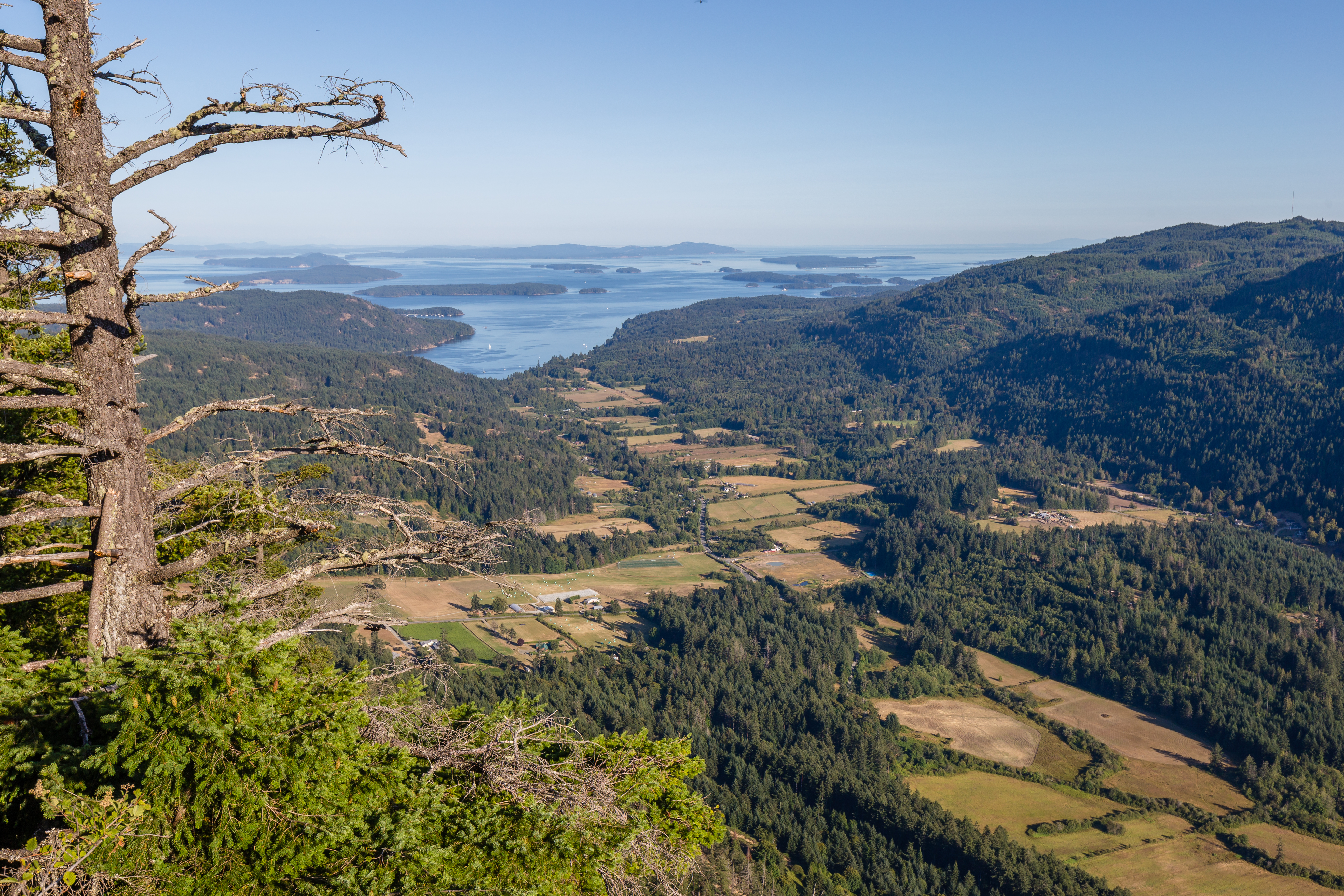
At the top, you’ll be rewarded with sweeping views of the Salish Sea, Vancouver Island, and the Gulf Islands. The summit is also a great spot for a picnic. Arrive around sunset to catch a spectacular display of colors in the sky.
Trail Tip: If you’re hiking near sunset, bring a headlamp to stay safe.
Ready for more exploration? The next trail promises its own unique experience.
2. Chris Hatfield Trail
The Chris Hatfield Trail links Channel Ridge to Salt Spring Island’s eastern shore, creating a direct path between Sun Eagle Drive and North View Place. This short but steep trail is ideal for those looking for a challenging outdoor workout. You can access it at the end of Sun Eagle Drive or between 255 and 285 North View Place.
Given the steep terrain, it’s important to wear sturdy footwear and be in decent physical shape before tackling this trail.
Next up: the Reginald Hill Path, a lesser-known treasure near Ganges Harbour. Keep reading to learn more.
3. Reginald Hill Path
The Reginald Hill Path is a 1,000-meter trail on southern Salt Spring Island, offering stunning views of Fulford Harbour and the surrounding landscapes. From the trail, you can take in sweeping vistas to the north, south, and west.
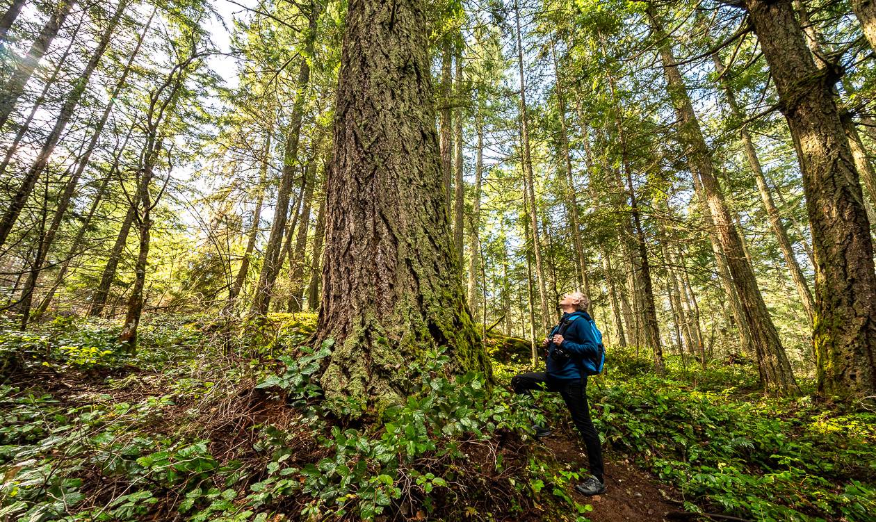
This path takes hikers through a mix of ecosystems, including mature Coastal Douglas-fir forests, Garry oak meadows, and rocky bluffs. It’s part of a 398-acre conservation area managed by the Nature Conservancy of Canada, highlighting some of the island’s most striking natural features. Walking this trail gives visitors a glimpse into Salt Spring Island’s conservation efforts before they venture further into its hidden trails.
“Reginald Hill is an incredibly special place in that the forest here remains ecologically productive and intact.”
– Krista Sheppard, Senior Director of Development and Communications, Nature Conservancy of Canada
Trail Details:
- Length: 0.62 miles (1,000 meters)
- Access: Walk-in only
- Highlights: Breathtaking views, rare ecosystems
Rules to Know:
- No dogs allowed
- No mountain biking
- No motorized vehicles
- No camping or fires
- No horseback riding
The trail runs near private property, so it’s important to stick to the marked paths. The area is rich in biodiversity, featuring small wetlands and woodlands that provide habitats for various species, including some at risk. Dr. Susan Hannon, a local ecologist and conservation biologist, explains the significance of this area:
“This is a special piece of land – it will be a jewel in the crown of protected areas on Salt Spring. It is large and relatively undisturbed, embedded in a landscape of other protected lands. For me, the highlights are the Garry oak ecosystems and the many small wetlands, providing habitat for several species at risk.”
– Dr. Susan Hannon
Situated near the Tsawout Reserve lands, the Reginald Hill Path is more than just a scenic hike – it’s a reminder of the importance of preserving the natural beauty and biodiversity of the region.
4. Duck Creek Park Trails
Duck Creek Park offers a short but scenic trail that highlights the beauty of Salt Spring Island. The Baker Ridge Trail, a 0.28-mile (450-meter) stretch, connects with the Quarry Drive Park Trail to form a loop.
As you walk, you’ll encounter moss-covered trees, a flowing stream, lush greenery, and a peaceful open meadow.
Trail Details:
- Length: Baker Ridge Trail – 0.28 miles (450 meters)
- Duration: About 45–60 minutes to complete the loop
- Difficulty: Challenging
- Best Time to Visit: Check tide tables beforehand
- Safety Tips: Be cautious on steep descents; high tide can limit beach access
Because of the steep sections and tide-dependent areas, take extra care while exploring this trail.
5. Mount Maxwell Trail to Baynes Peak
Mount Maxwell Trail to Baynes Peak is a must-visit for anyone seeking stunning views of Vancouver Island, the Gulf Islands, and mainland British Columbia.
The main trail starts at the end of Armand Way, connected by a short 0.22-mile (350-meter) path. Another option is accessing it via a gravel road leading into Mount Maxwell Provincial Park. The trail is moderately challenging, and maintenance becomes sparse once you leave the park boundary.
| Feature | Details |
|---|---|
| Length | 0.22 miles (350 meters) – Armand Way connector |
| Difficulty | Moderate |
| Maintenance | Limited beyond park boundaries |
Baynes Peak, the highest point on Mount Maxwell, is a fantastic spot for photography. From here, you can take in the sweeping views of the surrounding landscapes. Since the trails extend beyond the park, it’s essential to stick to marked routes and bring reliable navigation tools.
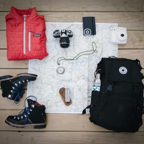
Tips for a great hike:
- Wear sturdy boots with good grip.
- Pack enough water, especially on warmer days.
- Start early to enjoy the best lighting and avoid crowds.
- Don’t forget your camera to capture the incredible views from Baynes Peak.
Next, we’ll explore the Channel Ridge South Walk, another lesser-known treasure worth discovering.
sbb-itb-09a2367
6. Channel Ridge South Loop
The Channel Ridge South Loop offers a relaxing hike through the natural beauty of Salt Spring Island. Perfect for casual walkers and those who enjoy soaking in the outdoors, this trail is a favorite among locals and visitors alike.
| Trail Features | Details |
|---|---|
| Difficulty Level | Easy |
| Trail Type | Loop |
| Highlights | Scenic views |
| Community Rating | 227 AllTrails reviews |
This trail system also connects to the Sun Eagle Trail, which leads to the eastern shoreline. While the main loop is gentle, the Sun Eagle Trail adds a steeper, more challenging section for those seeking a bit more adventure.
With its mix of accessibility and stunning scenery, the Channel Ridge South Loop is a must-visit. Up next, we’ll dive into the rugged charm of the Ruckle Park Shore Trail.
7. Ruckle Park Shore Trail
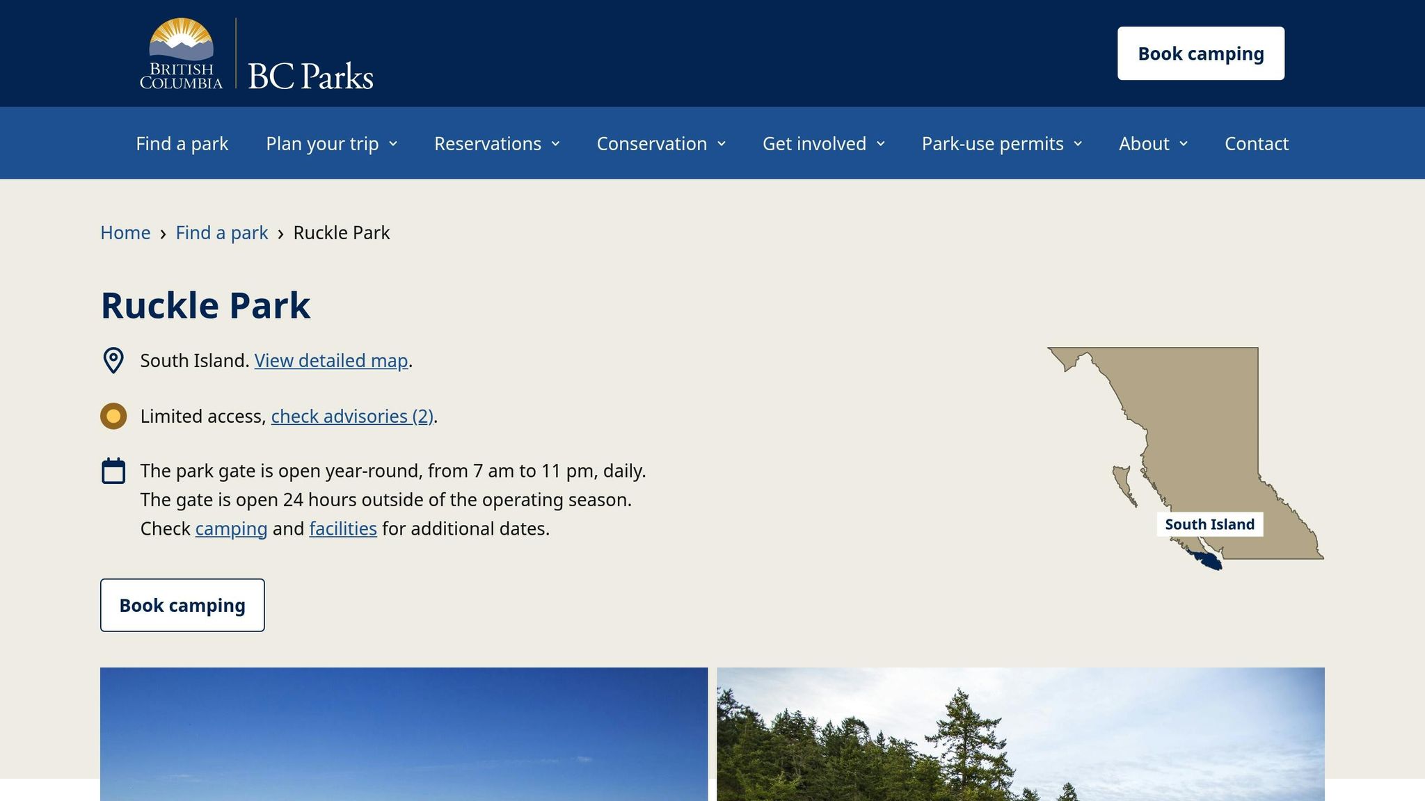
Located in the southeast corner of Salt Spring Island, the Ruckle Park Shore Trail offers a scenic coastal hike through unspoiled landscapes. The trail meanders through part of Ruckle Park’s 1,307 acres (529 hectares), showcasing ocean views and a variety of ecosystems.
| Trail Features | Details |
|---|---|
| Location | Southeast Salt Spring Island |
| Park Size | 1,307 acres |
| Trail Type | Coastal path |
Ruckle Park, once part of the Ruckle family estate and now a provincial park, combines outdoor recreation with efforts to protect its natural environment.
Highlights of the Trail
- Spectacular ocean views
- Rich coastal ecosystems
- Wildlife spotting opportunities
For those who enjoy variety, this rugged coastal trail offers a different experience from the gentler Channel Ridge South Loop, eventually connecting to the distinct features of the Burgoyne Bay Rock Trail.
8. Burgoyne Bay Rock Trail
Burgoyne Bay Rock Trail offers a rugged adventure with its striking boulder fields. Nestled within Burgoyne Bay Provincial Park, the trail provides a moderate challenge for those seeking something different from the usual forest paths. Its unique terrain and scenic rest spots make it a favorite for hikers exploring beyond Ganges Harbour.
| Trail Details | Information |
|---|---|
| Access Point | Burgoyne Bay public dock |
| Difficulty | Moderate |
| Trail Features | Boulder field, marked paths |
| Notable Elements | Rest spots, clear signage |
Frequent rest areas along the trail let hikers pause and take in the surroundings. Even with its rocky sections, the trail is easy to follow thanks to clear markers throughout.
Getting There
To start the trail, head to the public dock at Burgoyne Bay. If you’re arriving by boat from Ganges Harbour, plan your trip around tidal changes to ensure smooth access to the southeastern delta.
Trail Experience
The trail is well-marked and offers a mix of challenges, including natural boulders and shaded rest spots. It’s a rewarding hike for those with average fitness, as long as care is taken on the rocky portions. The trail also connects to other paths in the Burgoyne Bay area, allowing for longer hikes and further exploration of this beautiful region.
9. Peter Arnell Park Loop
Peter Arnell Park Loop is a standout trail on Salt Spring Island, offering sweeping views and a direct link to Bryant Hill Park through a well-maintained connector trail.
| Trail Details | Information |
|---|---|
| Trailhead Location | End of Sarah Way (gravel road) |
| Key Features | Mt. Maxwell viewpoint, Active Pass vista |
| Connected Trails | Bryant Hill Park connector |
| Notable Views | Galiano Island, Active Pass |
| Parking | Available at trailhead |
Getting There
Head to the end of Sarah Way, where a gravel road begins. You’ll find parking at the end of this road.
Trail Experience
The loop is known for its stunning views of Mt. Maxwell, Active Pass, and Galiano Island, especially on clear days. It’s a great spot for taking in the natural beauty of the area.
Trail Connections
This trail connects seamlessly to the Bryant Hill – Peter Arnell Connector Trail, which opens up access to a larger network of trails. Whether you’re looking for a quick walk or a longer adventure, this connection provides a variety of terrain and additional viewpoints to explore.
10. Hope Hill View Trail
Located in the 80-acre Bryant Hill Park, the Hope Hill View Trail offers a 1.4-mile loop through lush forest, perfect for hikers seeking a bit of a challenge.
| Trail Details | Information |
|---|---|
| Trail Length | 1.4 miles (loop) |
| Difficulty | Moderate to challenging |
| Key Features | Forest paths, stream crossings, scenic viewpoints |
| Best For | Experienced hikers |
| Notable Views | Mt. Maxwell, Active Pass, Galiano Island |
Trail Description
The trail begins with a gentle 0.6-mile stretch along an old logging road – an easy start to warm up. Around 820 feet in, you’ll find a connector leading to Peter Arnell Park.
Terrain and Challenges
After crossing a small stream, the trail gets steeper, climbing back up from the initial descent. From there, it alternates between uphill and downhill sections, keeping things interesting. A final bridge crossing marks the end of the loop, bringing you back to where you started.
Important Considerations
This trail demands proper footwear due to its uneven terrain, so sturdy hiking boots or shoes are a must. It’s not a suitable route for strollers or young children.
Trail Features
The loop takes you through a mix of forested landscapes, with natural stream crossings and notable changes in elevation. Each section offers something different, whether it’s a quiet forest moment or a stunning viewpoint, making it a rewarding hike for those ready to take it on.
Hiking Tips and Safety
Get ready for your hike by preparing properly and respecting trail rules to ensure a safe and environmentally conscious experience.
Trail Etiquette and Environmental Protection
The Gulf Islands National Park Reserve offers this advice:
“Leave all natural objects such as shells, marine creatures, plants and other treasures that you may find on the shoreline where you have found them so that others have a chance to discover them. Even shells are part of the marine ecosystem and provide shelter for other small creatures.” – Gulf Islands National Park Reserve
- Stick to marked trails to avoid harming delicate vegetation and habitats.
- Carry out all your trash and avoid disturbing natural objects.
- Be careful on rocky shorelines to avoid damaging marine ecosystems.
By following these steps, you help protect the natural beauty and wildlife of the area.
Wildlife Awareness
Always keep dogs on a leash. This ensures the safety of both your pet and the wildlife you may encounter.
Summary
Salt Spring Island boasts a variety of trails near Ganges Harbour, catering to hikers of all skill levels. From the steep climb up Mount Maxwell Trail to the peaceful paths of Duck Creek Park, these trails offer breathtaking views and a chance to immerse yourself in nature.
For a convenient starting point, consider staying at Mariner’s Loft. It provides stunning harbor views and is just a short distance from many trailheads.
The Salt Spring Trail and Nature Club hosts guided hikes from September to June, offering opportunities to explore trails like the steep Reginald Hill or the scenic coastal paths of Chris Hatfield Trail. These lands also carry deep significance, honoring the Hul’qumi’num and SENĆOŦEN peoples.
Here’s a quick guide to trails by difficulty:
- Beginner: Duck Creek Park, Channel Ridge South Walk
- Moderate: Mount Erskine, Chris Hatfield Trail
- Advanced: Mount Maxwell Trail to Baynes Peak
After a day of hiking, unwind at your accommodation and start planning your next outdoor adventure.